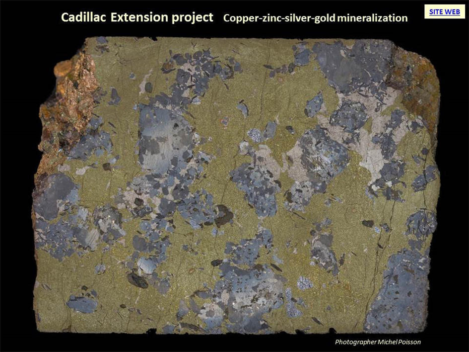
Hosts the Copper-Zinc-Silver-Gold Langlade deposit. VMS mineralization typical of the Abitibi.
On April 13th, 2021, Cartier transferred to SOQUEM all of its rights and interests in a group of 39 claims comprising the Cadillac Extension Property. SOQUEM granted Cartier a 1% NSR royalty on the Cadillac Extension Property, which may be bought back at any time by SOQUEM for a consideration of $1,000,000 (the “Cadillac Extension Royalty”). SOQUEM has a right of first refusal with respect to any future disposition to a third party by Cartier of the Cadillac Extension Royalty, subject to certain exceptions.
-
UPDATED : September 22st, 2016
PROJECT
Cadillac Extension
STATUS
Exploration drilling to discover additional polymetallic massive sulphide deposits
COMMODITIES
Zinc, Copper, Gold and Silver
LOCATION
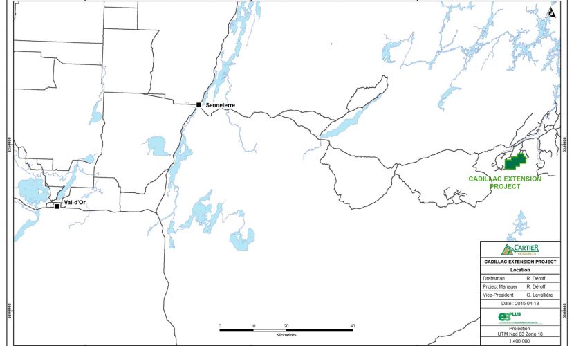
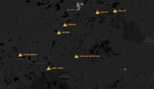
110 km east of Senneterre, Quebec (Figure 1)
Township : Baudin
Map Sheets SNRC 32B04 and 32B05
Latitude : 48° 14′ 21″ N
Longitude : 75° 58′ 26″ WCLAIMS STATUS
The property consists of 39 claims of 2 235 hectares (Figure 2).
OWNERSHIP
Cartier Resources owns 100% interests of the property.
ROYALTIES
No royalty on the property.
KEY POINTS
- Favourable horizon of 5 km by 1 km wide for the exploration of volcanogenic massive sulphide deposits (Figures 3 and 4);
- Langlade massive sulphide deposit located on the favorable horizon (Figure 5 and 14);
- The deposit is drilled to 200 m depth (Figures 5 and 6);
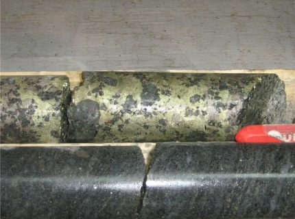
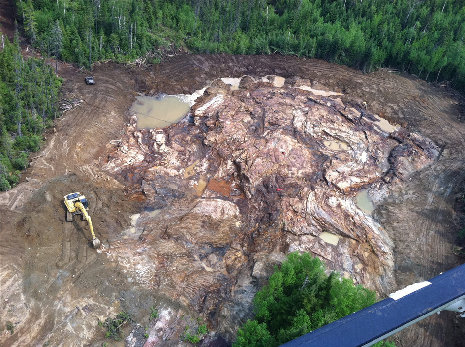
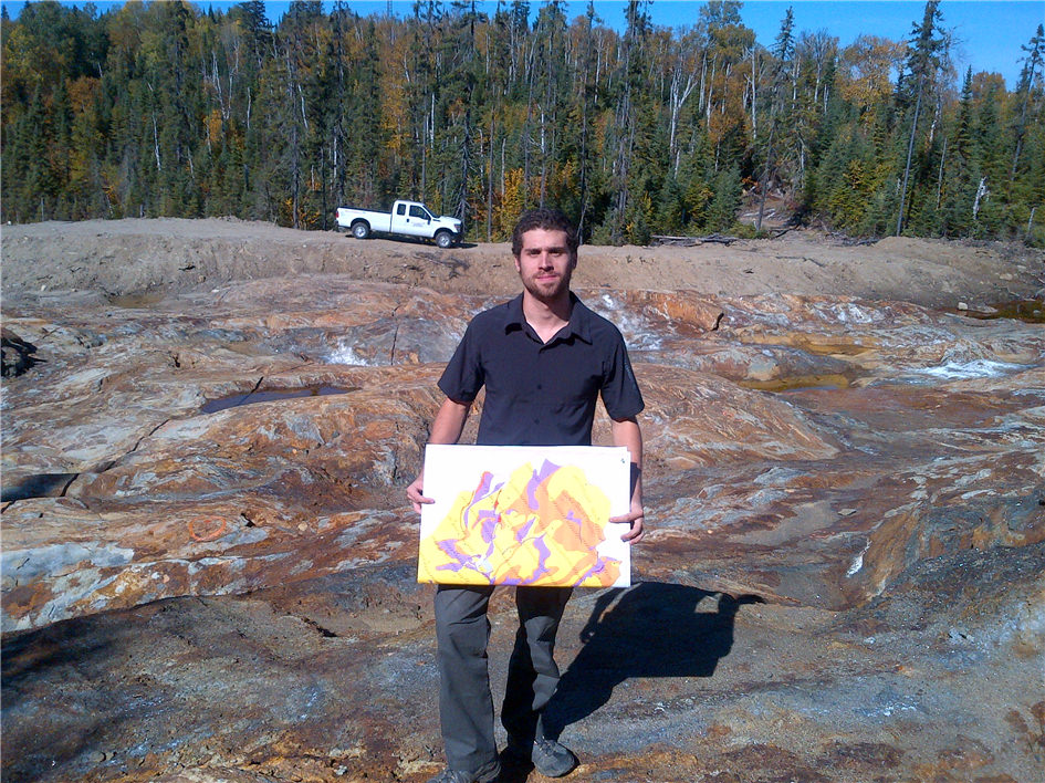
- The mineralogical caracteristics of the deposit are exposed by a trench (Figure 7);
- Preliminary metallurgical study of the Langlade mineralisation;
- The OreVision and magnetometric 2015 surveys generated 7 target zones that prioritize exploration along the favourable horizon in 2 areas of the property (Figures 11, 12 and 14).
-
UPDATED : February 9th, 2016
PROJECT CHARACTERISTICS
- Langlade volcanogenic massive sulphide deposit (Figures 5, 6 and 7);
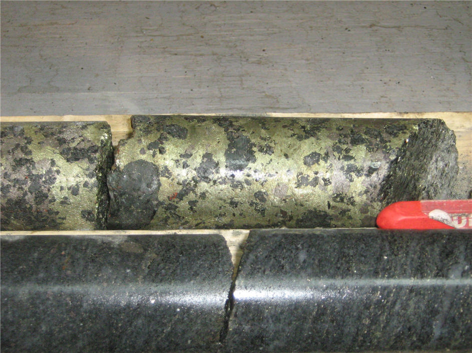
- The Mineralisation consists of chalcopyrite, sphalerite, pyrrhotite and pyrite dissiminated and locally massive (Pictures 1, 2, 3, 4 and 5) . The footwall rocks are felsic gneiss (Pictures 6 and 7) and those of the hangingwall mafic gneiss;
- The Langlade massive sulphide deposit was drilled to 200 m depth (Figures 5 and 6);
- A total of 37 holes, totaling 8,503 m, was carried on and around the Langlade Deposit (Cominco 1992-94 et Cartier Resources 2011-12);
- Best intercepts in drilling are presented in the BEST RESULTS Table;
- Trenching of mineralised zone (7,000 m²), 609 channel samples (Cartier Resources 2011, Picture 1);
- Best intercepts in trenching are presented in the BEST RESULTS Table;
- 63 electromagnetic anomalies (Questem airborne survey);
- Favourable horizon of 5 km by 1 km wide for the exploration of volcanogenic massive sulphide deposits (Figures 3 and 4);
- OreVision and magnetometric surveys of 80 km were completed in 2015;
- The survey generated 7 target zones that prioritize exploration along the favourable horizon in 2 areas of the property (Figures 11 and 12).
PREVIOUS WORK
1991
Cominco Ltd carries out QUESTEM airborne magnetometric and electromagnetic surveys totalling 10,297 km. These surveys have generates 137 conductive anomalies (GM 51754, GM 51758, GM 51936 and GM 52742).
Geological and geochemical surveys collected 300 samples;
A helicopter-borne survey of VLF type of 75 km lead to the discovery of Langlade showing (GM 51754);
a Max-Min survey of 144 km generated 25 conductive anomalies;
A magnetometric survey of 164 km and a gravimetric survey of 22 km were completed;
A geological mapping of 33 km², prospecting and ground geochemistry collected 1,300 samples (GM 51754, GM 51756, GM 51757);
A stripping program (2,500 m3) for 24 trenches on the Langlade showing. A sulphide horizon returned 16.0 % Zn, 4.2% Cu, 38 g/t Ag and 0.44 g/t Au over 1.1 m (GM 51754).
1992
Cominco conducts a Max-Min survey of 100 km and a magnetometric survey of 114 km, generated 28 conductors (GM 51755);
A 12 hole drill program totalling 2,150 m (holes 4CW-92-1 to 4CW-92-12) concentrates on the mineralized zone. The best grades are from hole 4CW-92-1 with 0.96% Zn, 0.70% Cu, 42 g/t Ag and 0.22 g/t Au over 48.20 m including an interval of 9.30% Zn, 5.50% Cu, 186 g/t Ag and 0.28 g/t Au over 0.95 m (GM 51754, GM 52742, GM 58489 and Cominco’s documents);
Surface and borehole pulse-EM are carried out (GM 51754). Cominco conducts a 1,400 km airborne magnetometric and electromagnetic GeoTEM survey (GM 51937), another magnetometric survey totalling 64 km and a Max-Min survey of 62 km (GM 51938);
1993
Cominco Ltd drills 5 holes totalling 1,452 m. The best values obtained from the program are: 1.70% Cu and 3.30% Zn over 0.68 m (hole 4CW-93-13), 0.20% Cu and 1.80% Zn over 1.17 m (hole 4CW-93-14) and 0.16% Cu and 1.70% Zn over 1.46 m (4CW-93-15) (GM 52742);
1993
Louvem mandate Val-d’Or Géophysique to carry out magnetometric and electromagnetic surveys of 19 km each (GM 52242);
1994
Cominco Ltd drills 2 holes totalling 1,862 m (4CW-94-16 and 4CW-96-17) on Langlade deposit (1,862 m in total) (GM 58489);
1994
Réjean Girard and James Moorhead provide a geological synthesis at a scale of 1:250,000 with some at 1:50,000 scale, for the area (MB 94-34);
2000
Pierre Gaucher discovers new conductive zones 200 m north of the deposit. After blasting, he samples seven conductors and obtains up to 0.6% Cu and 0.7% Zn (GM 58490);
2004
Consorem completes a geophysical interpretation of the Achaean parautochtonous and Proterozoic allochthonous domains of the Grenville Province to the east of the Abitibi Subprovince. Consorem examines 4 issues: favorable lithologies for mineral exploration (mafic gneiss and amphibolites), the relationship between metamorphism and geophysics, lineaments, and a regional-scale exploration guide for gold and volcanogenic mineralization (GM 64092);
2010
The MRNF publishes the results of an airborne magnetometric survey (total field and vertical gradient) flown east of Senneterre, straddling the Grenville and Superior provinces (DP 2010-04).
ACCESS TO PROPERTY
From Senneterre along N-806 forestry road for 110 km (Figure 1). Then north to access the property.
The Senneterre – La Tuque, CN railroad cuts the central portion of the property near Langlade, 900 m south of the Langlade deposit.
GEOLOGICAL SETTING
The property is located in the Grenville geological Province wich covers the eastern extensions of the geological province of the Abitibi structures. Grenville gneisses are interpreted as metamorphic equivalents of the rocks of the Abitibi ; paragneiss are sediments, orthogneiss are granitoids and amphibolites are volcanic rocks.
The rocks have a banding or a well-developed foliation. The banding roughly follows the direction N060°-N240° typical of the area wich is parallel to the Grenville Front. The foliation is generally associated with a streching lineation plunging with a moderate angle varying between N090° to N120° directions.
The rocks attained at least upper amphibolite facies in a high pressure and temperature environment (7-10 kbars and 650-800°C). This metamorphism is characterized by biotite-orthoclase-kyanite, biotite-sillimanite-garnet and hornblende-clinopyroxene-garnet parageneses.
The hydrothermal alteration zones are identified by the presence of garnet, graphite and sulphides.
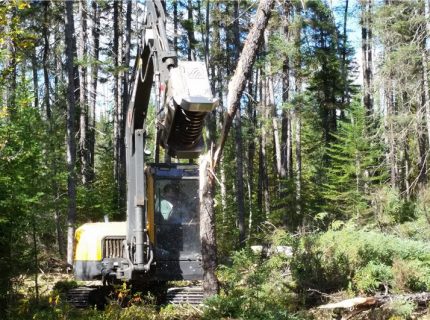
WORK COMPLETED BY CARTIER RESOURCES
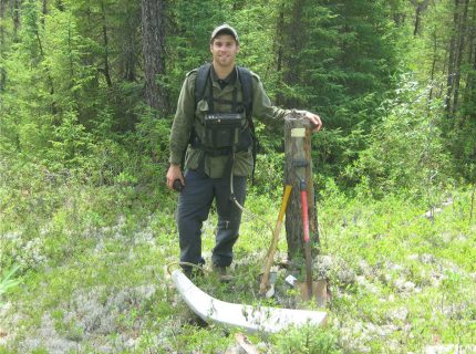
2009
- Till survey : 161 samples collected;
- Several gold anomalies (up to 13.6 g/t Au) were generated;
- Staking the Cadillac Extension property;
2010
- Prospecting and sampling program : 69 mineralised blocks, 51 grab samples and 227 channel samples. Several gold and base metal anomalies were generated;
2011
- Beep mat prospecting with 50 grab samples collected;
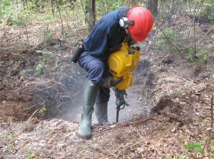
- Trenching program on Langlade: 7,000 m² with 609 channel samples and 55 whole rock samples collected. Geological and structural mapping of both exposures;
- Line cutting and dipole-dipole IP survey of 12 km (a = 25 or 50 m, n = 1 à 8);
- Soil sampling program : 339 humus samples and 108 till samples collected. Many gold anomalies (up to 4.3 g/t) were generated;
- 10 drill hole totaling 1,187 m to explore the extensions of Langlade deposit;
- COREM metallurgical study;
2012
- Line cutting and magnetometric survey of 56 km and 3D IPower survey of 23 km over and surrounding Langlade deposit;
- Line cutting and 67 km IP survey (dipole-dipole, a = 25, n = 1 to 8);
- 14 drill holes program totaling 2,666 m to explorer the extensions of Langlade deposit;
- Pulse-EM survey of 4 drill holes totaling1,130 m;
- Geological and structural mapping along cut lines and new access roads.
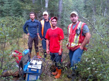
2015
- Figures 8 et 9 presente the developed approach i) to determine the optimal geophysical method to use to search Langlade mineralisation type on this property and ii) to determine the optimal configuration of the various parameters of the used method;
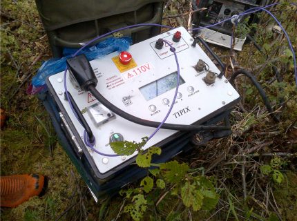
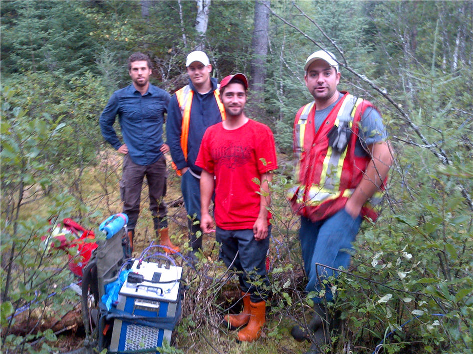
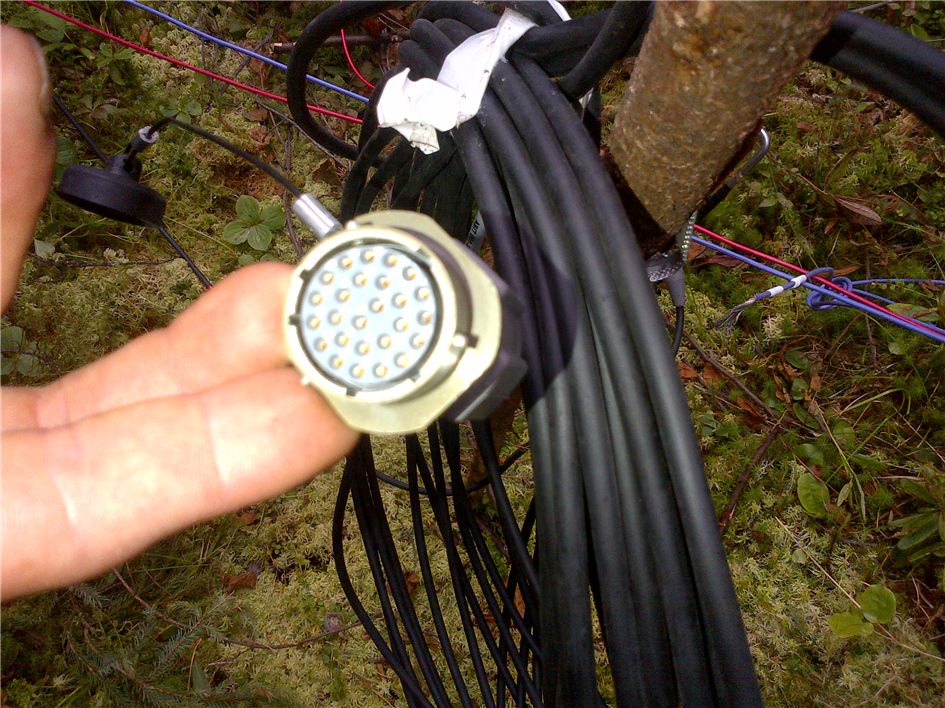
- Line cutting, OreVision and magnetometric surveys of 80 km on the Western and Eastern portions of the property (Figure 10);
- Generation of 7 target zones that priorize exploration along the favourable horizon in 2 areas of the property (Figures 11 and 12).
PLANNED WORK
2016 Exploration work to optimise the drill holes position in the 7 target zones (Figures 11 and 12).
-
Main results
- 2015 OreVision Survey Results Download
- BEST RESULTS Download
- Figure 1 - Property Location Download
- Figure 2 - Claims Map Download
- Figure 3 - Cadillac Extension VMS Potential Download
- Figure 4 - Cadillac Extension Magnetometric Plan View Download
- Figure 5 - Composite Cross Section 90E of Langlade Deposit Download
- Figure 6 - Longitudinale Section of Langlade Deposit Download
- Figure 7 - Langlade Deposit Channel Sampling Results Download
- Picture 1 - Langlade Massive Sulphides Deposit Download
- Picture 2 - Langlade Massive Sulphides Download
- Picture 3 - Langlade Massive Sulphides Download
- Picture 4 - Langlade Massive Sulphides Download
- Picture 5 - Langlade Massive Sulphides Download
- Picture 6 - Langlade Gedrite Alteration Download
- Picture 7 - Langlade Biotite and Garnet Alteration Download
- Picture 8 - Samples to determine the geophysical characteristics of the Mineralisation Download
- Picture 9 - Ground OreVision QAQC August 2015 Download
- Figure 8 - Physical Properties Cadillac Extension.pdf Download
- Figure 9 - Geophysical Calibration Ground Tests Results Download
- Figure 10 - 2015 OreVision Survey Download
- Figure 11 - 2015 OreVision Survey Results Download
- Figure 12 - 2015 OreVision & Mag Survey Results Download
- Figure 13 - Drilling target zones Download
- Massive Sulphides (Cu, Zn, Au, Ag) Download
- Figure 14 - Longitudinal and Plan View of Langlade Potential Download
- Plan View 2017 Drill Results Download
Other documents
- Preliminary metallurgical study Download


